Statewide Riparian Opportunity Assessment
Project Sponsor: New York State Department of Environmental Conservation - Division of Lands & Forests
End Date: Nov. 30, 2017
Summary
This project provides the DEC’s Division of Lands and Forest with a riparian land inventory and opportunity assessment to strategically identify and prioritize sites for implementation of DEC’s Trees for Tribs program and other riparian restoration efforts within New York. The primary goal of this assessment is to identify target locations where enhancement of riparian buffers will produce tangible benefits by improving water quality (reduction of nutrient and sediment loading, erosion control, etc.) and habitat quality (riparian cover, habitat connectivity, etc.). A secondary goal of this assessment is the identification of opportunities for riparian protection, including conservation easements and land acquisition.
Products
Downloads
- Project report (PDF, 9.5 MB)
- Geodatabase (ZIP, 77.2 MB)
- Riparian buffers shapefile (ZIP, 932 MB)
- Appendix E (XLSX, 69.9 KB)
News
View a recording of our April 19, 2018 Webinar!
Prioritizing Riparian Restoration and Protection Sites
The goal of the Statewide Riparian Opportunity Assessment is to support the identification and prioritization of riparian sites for restoration or protection, in support of New York DEC’s Trees for Tribs program, which enlists the help of volunteers to plant native trees and shrubs in riparian buffers to improve wildlife habitat, water quality, climate resiliency, and to provide flood protection during storm events.
The assessment products can also be used for related conservation work, including: conserving and restoring native fish and wildlife biodiversity and habitats, improving water quality, and enhancing community resiliency and ecosystem integrity. The results have been packaged into a suite of tools that conservation practitioners, watershed stakeholders, and others can use to inform their decisions about where to perform riparian restoration and protection work in their region. Site-specific knowledge is imperative and field validation is a necessary step before actual implementation of conservation actions by those who use these tools.
Methodology: Quantifying Ecological Condition
We assessed habitat condition using two scales : the larger unit of evaluation was the HUC12 sub-watershed, and the smaller unit was the catchment, small drainage areas that empty into a single reach. The sub-watershed scores are useful for comparing habitat condition across the entire state, while the catchment scores provide information about the relative condition of areas within a sub-watershed.
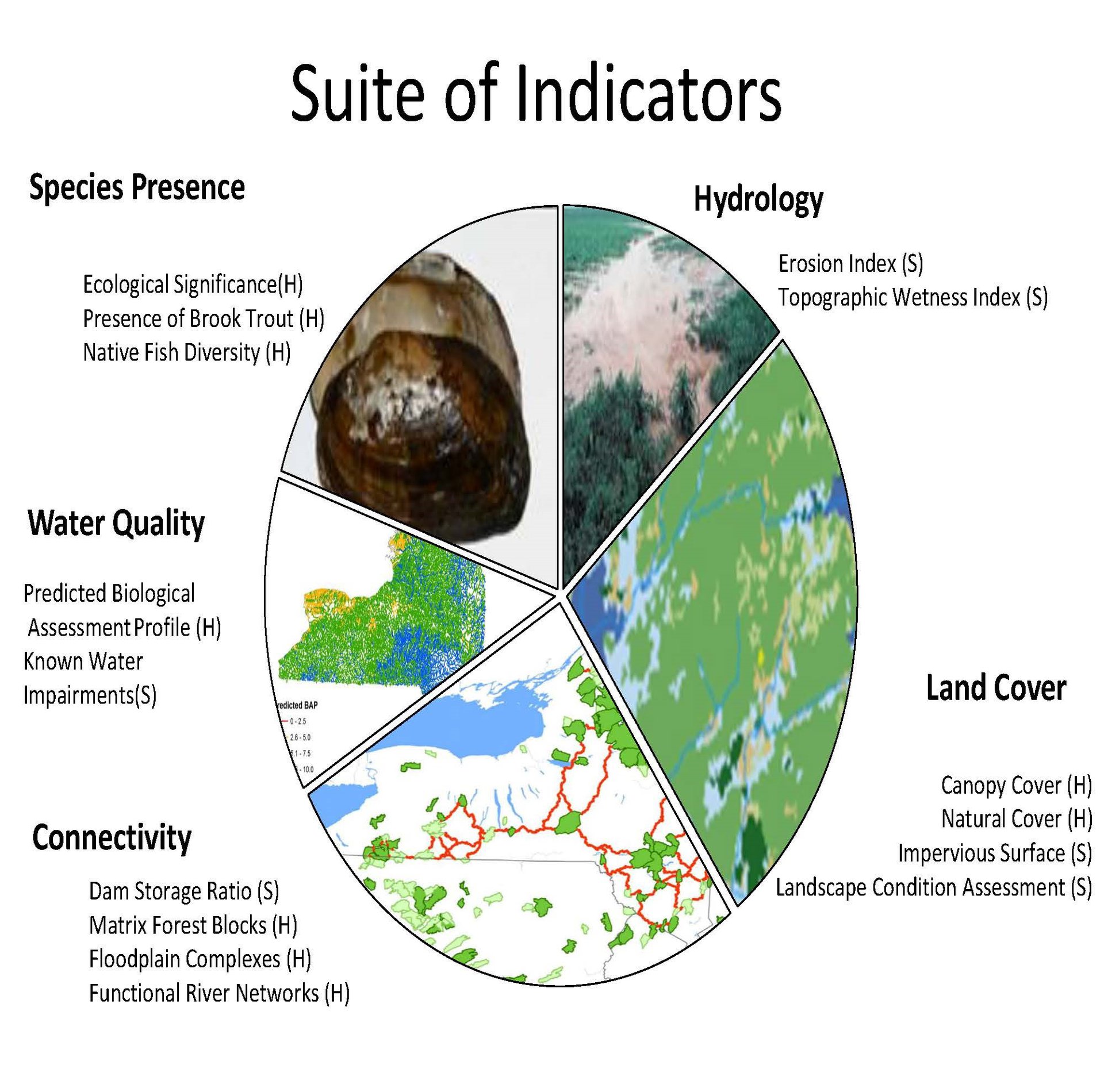
We based our assessment of habitat condition on nine ecological health indicators and seven ecological stress indicators. We describe all indicators in more detail in our project report (PDF, 9.5 MB) and the Trees for Tribs Indicator Table (XLSX, 29 KB).
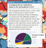
Our products include two ArcGIS Online Maps, one for sub-watersheds and one for catchments, which users can access through a web browser. The online maps provide the ability to visualize all the scores developed on the assessment. Pop-up windows provide access to additional information.We calculated several composite scores, which combined the scores of related indicators into a single value representing overall Ecological Health and Ecological Stress, as well as a Comprehensive score, which utilizes all health and stress indicators and reflects overall condition. Such a ranking does not necessarily determine the amount of action needed; however, it helps practitioners understand the likely type of action most applicable within each basin (such as restoration or protection).
We strongly recommend referencing the project report when using our products, where you will find a full description of our methods, metrics, and user guidance.
Catchments online map.
View or Access Data
Online Maps
Our products include two ArcGIS Online Maps, one for sub-watersheds and one for catchments, which users can access through a web browser. The online maps provide the ability to visualize all the scores developed on the assessment. Pop-up windows provide access to additional information.
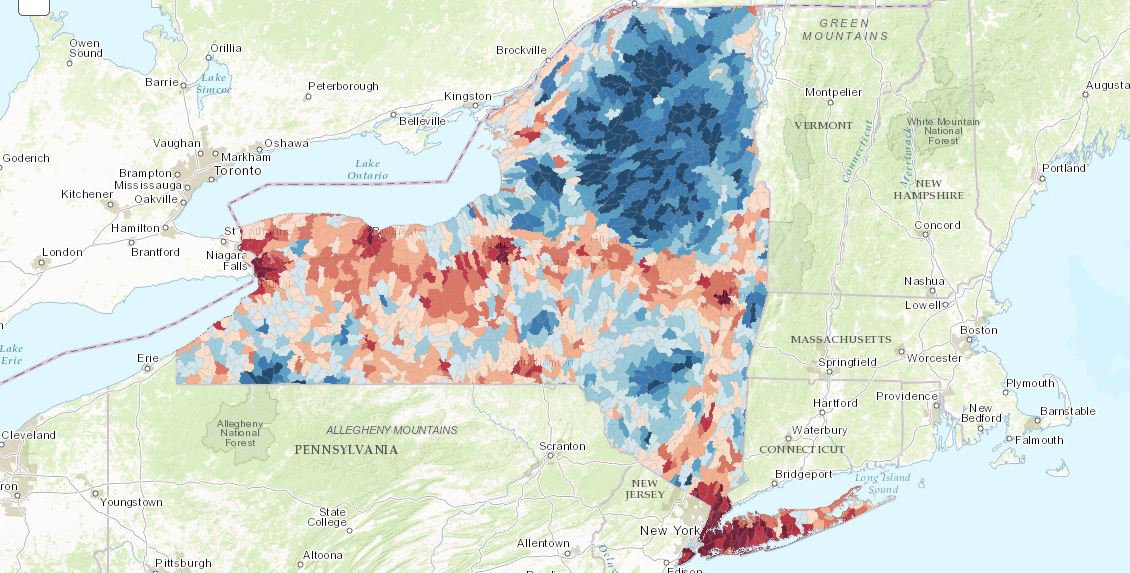
Sub-watersheds online map.
Data Explorer
Users can also explore the results using our custom application, the Data Explorer; an online tool which uses interactive maps and plots to help prioritization.
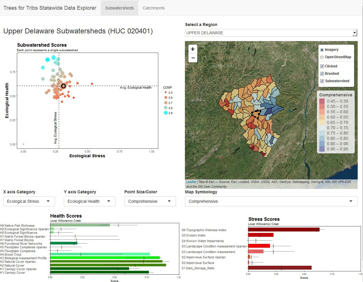
Trees for Tribs Statewide Data Explorer.
Both the maps and the Data Explorer allow users to either explore broadly, or investigate with a specific conservation goal in mind. To assist you, there is a guided tour on the Data Explorer to introduce users to all its functions, as well as a set of case studies included in our report to offer examples of how this data set may be used to answer specific questions. We further suggest all users read and understand the methods in our report to assist you in determining how best to use our tools.
Downloadable Products
In addition to the online products, users with GIS capability can download the Trees for Tribs GIS results geodatabase (ZIP, 77.2 MB). It includes feature classes of the sub-watershed and catchment results.
Riparian Buffers
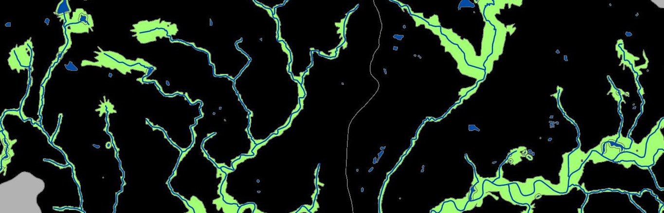
We generated a set of variable width riparian buffers as part of the assessment process to score habitat quality within the riparian zone. These buffers are available as a shapefile (ZIP, 932 MB). The buffers are not to be redistributed or used for any purpose other than aiding in the review of the results of this assessment. Full details about methods used to derive the buffers can be found in the project report and Appendix E (XLSX, 69.9 KB). They should not be confused with flood risk maps, which can be obtained from FEMA and other explicit flood risk mapping projects. The tool used to create the buffers can be found online at Riparian Solutions.
About
The project began April 1, 2016 and concluded January 2018. The New York Natural Heritage Program (NYNHP) of the State University of New York College of Environmental Science and Forestry (ESF) developed the project for the New York State Department of Environmental Conservation’s (NYS DEC) Division of Lands and Forests.
The project steering committee included members from the NYS DEC's Division of Lands and Forests, Division of Water, Division of Fish and Wildlife, Great Lakes Program, and Hudson River Estuary Program and Cornell University; The Nature Conservancy Eastern and Central/Western NY Chapters; NYS Soil & Water Conservation Committee; the NYS Department of Agriculture and Markets; NYS Department of State; and the Upper Susquehanna Coalition.
This project is a follow-up and expansion of the riparian assessment completed in the Great Lakes Basin.
Dec. 10, 2020 | Updated Feb. 7, 2021, 12:25 p.m.