Modeling and Analytics
We use a variety of analytic and modeling methods to support the mission of our program. Modeling projects help us prioritize field work and transform data collected by our scientists into tools that support conservation efforts across New York. We also take on projects that are regional in scope, resulting in species and land conservation beyond New York State.
Datasets and Tools
Many of the data sets derived from our work are available from individual project pages (linked below or elsewhere on this site). For specific data layers, visit our data download page.
Data DownloadSpecies Distribution Modeling
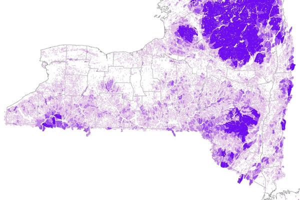
Species distribution modeling combines the data from Natural Heritage rare species occurrences with remotely sensed environmental data to create maps of predicted suitable habitat for rare plants and animals.
Modeling ProjectsAssessments
Analyses of habitat condition, connectivity, or suitability can combine field data with remotely sensed datasets to create wall-to-wall assessments.
Habitat AssessmentsPrioritization Tools
Our prioritization projects support conservation efforts by highlighting where specific conservation activities are likely to be the most effective or have the biggest impact.
Prioritization ToolsSpotlight: Forest Patch Condition
Creating and ranking forest patches in the Hudson Valley.
Forest PatchesSpotlight: Trees for Tribs
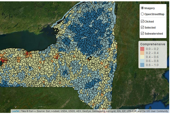
Prioritizing catchments for riparian restoration throughout New York State.
Trees for Tribs