Development of Wetland Assessment Protocols in New York
Project Sponsor: US Environmental Protection Agency - Region 2 Wetland Program
End Date: March 31, 2016
Summary
Developing NYS’ first three-tiered protocol for assessing wetland condition including the first publication of our NY Rapid Assessment Method (NYRAM).
Wetland ecosystem services such as stormwater management, water quality, and water security, are a function of wetland condition. This project addresses the absence of monitoring protocols for freshwater wetlands in New York State (NYS), a need identified in the New York State Water Quality Monitoring Program Strategy 2005-2014 (June 2006). Our objectives were to: 1) assess the condition of NYS wetlands using a three-level sampling approach, and 2) develop a Rapid Assessment Method (RAM) that effectively quantifies wetland condition ("Level 2"). To assess the condition of NYS wetlands remotely ("Level 1"), we developed a statewide Landscape Condition Assessment (LCA) model that cumulatively depicts anthropogenic stressors across the New York landscape (30 x 30-m resolution). Rapid assessment methods developed for Level 2 quantified anthropogenic stressors using basic air photo interpretation and field surveys. At the finest scale of measurement ("Level 3"), plot arrays captured vegetation structure and floristic biodiversity. To create an effective but relatively simple Level 2 protocol that could easily be used by others throughout New York, we used partner feedback and data from Levels 1 and 3 to test, refine, and support the Level 2 rapid assessment method ("NYRAM"). The end result is a set of robust wetland assessment protocols using a three-level sampling design. This flexible method allows practitioners to select the level of sampling that is most applicable to their project goals and resources.
Final Report

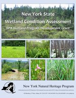
Preferred Citation: Laura J. Shappell, Aissa L. Feldmann, Elizabeth A. Spencer, and Timothy G. Howard. 2016. New York State Wetland Condition Assessment. EPA Wetland Program Development Grant. Final Report. New York Natural Heritage Program, Albany, NY. Final report (PDF, 2.9 MB).
Project Deliverables
Level 1 - Landscape Condition Assessment (LCA)
The final rasterized model represents cumulative anthropogenic stressors across New York State. Download the model as a GIS layer.
Documentation and development of the LCA model is describe in Appendix A of the final report (PDF, 2.9 MB). LCA citation: Aissa Feldmann and Tim Howard. 2013. Landscape Condition Assessment (LCA2) for New York. NYNHP, Albany, NY.
Level 2 - New York Rapid Assessment Method (NYRAM ver. 4.2)
NYRAM field manual and field worksheets are included in the report above and Supporting Actionable Decision-Making for Wetland Permitting in New York from Urban to Rural Environments
Partners
NYS DEC, SUNY College of Environmental Science and Forestry, and the Upper Susquehanna Coalition (USC)

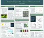
A Three-Tiered Approach to Wetland Condition Assessment (PDF, 1.7 MB)
New York State Wetlands Forum 2017 Conference Poster
Research Topics/Keywords
wetland condition assessment, rapid assessment method, three-tiered assessment, wetland floristic quality, wetland monitoring, Landscape Condition Assessment model (LCA)
Dec. 9, 2020 | Updated Feb. 22, 2023, 5:30 p.m.